

Hike to lake Carezza
The Hotel ADLER Carezza is one of the closest hotels lake carezza.
From Hotel ADLER Carezza follow path 10A to hike to lake Carezza. The path climbs steeply at the beginning, then flattens. It follows the river from Passo Carezza and soon crosses the hill by a short climb. You’ll then see another brook springing from the lake. Follow it and the path under the spruce trees to reach the creek sources. The water level changes with the lake level.

Your hike through the forests does not take for long. Shortly after, the climb is over, you will find yourself immersed in the captivating beauty. Cross the street through the underground passage, and you will be greeted by the mesmerizing shore of Lake Carezza. This enchanting alpine lake, the well known lago di Carezza or Karer See, boasts stunning emerald waters and is framed by the imposing peaks of the Dolomites.
The underpass you walk through can be flooded when the lake Carezza fills up compleately in mid-June and during hefty rain falls in November. This temporary natural event adds an interesting aspect to the experience, showing how the stunning alpine landscape is always changing.

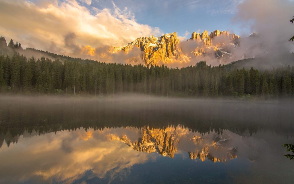


We recommend you walk around the lake, especially at sunrise and sunset. Everything is peaceful, and the colors are reflected in the emerald green water, creating a serene experience. The golden hues of the sun blend with the tranquil waters, creating a breathtaking symphony of colors dancing across the horizon. Whether you choose to stroll in the soft morning light or bask in the tranquil ambiance of the evening, each moment offers a unique perspective of the picturesque landscape.
In order to reach back, follow the same route, as priory described.
Alternatively, follow trail 6, and at the junction take trail 7 in the direction towards Welschnofen|Nova Levante. After 300 m turn left and take the very steep path 7A, which leads back to the Hotel ADLER Carezza.
[osm_map_v3 map_center=”autolat,autolon” zoom=”autozoom” width=”100%” height=”450″ file_list=”../../../../wp-content/uploads/gpx/Lake-Carezza-10A-6-7.gpx” file_color_list=”grey” control=”fullscreen,scaleline,overview” file_title=”Lake-Carezza-10A-6-7.gpx” bckgrndimg=”GDPR_bckgrnd.png” ]
| distance: | 4,4 km | |
| elevation difference: | 180 m | |
| departure elevation: | 1390 m | |
| maximum elevation: | 1570 m | |
| hiking time: | 1:20 | |
| | | seasonal availability: | year through |
| lifts to be used: | none | |
| public bus timetable | ||
| Lunch at gastronomy around the lake or lunch package | ||
| Download gpx file |
Please read on here on how to best prepare for your hike.